Solapur District
History
HISTORICAL IMPORTANCE
The Solapur District was ruled by various dynesties such as Andhrabhratyas, Chalukyas, Rashtrkutas, Yadavas and Bahamanis. ‘SOLAPUR’ is believed to be derived from two words ‘SOLA’ meaning sixteen and ‘PUR’ meaning village. The present city of Solapur was considered tp be spread over sixteen villages viz. Aadilpur, Ahmedpur, Chapaldev, Fatehpur, Jamdarwadi, Kalajapur, Khadarpur, Khandervkiwadi, Muhammadpur, Ranapur, Sandalpur, Shaikpur, Solapur, Sonalagi, Sonapur and Vaidakwadi.
Recent research work however shows that the name SOLAPUR is derived not from the congregation of sixteen villages. It is evident from the inscriptions of Shivayogi Shri.Siddheshwar of the time of the Kalachuristis of Kalyani, that the town was called ‘Sonnalage’ which came to be pronounced as ‘Sonnalagi’. The town was known as Sonnalagi even upto the times of Yadavas. A sanskrit inscription dated Shake 1238, after the downfall of the Yadavas found at Kamati in Mohol shows that the town was known as Sonalipur. One of the inscriptions found in Solapur fort shows that the town was called Sonalpur while another inscription on the well in the fort shows that it was known as Sandalpur.
During the Muslim period, the town was known as Sonalpur. It is therefore most probably that that during the course of time the name Solapur was evolved by dropping ‘na’ from the name Sonalpur. Subsequently the British rulers pronounced Solapur as Sholapur and hence the name of the district.
The present Solapur district was previously part of Ahmednagar, Pune and Satara districts. In 1838 it became the Sub-district of Ahmednagar. It included Barshi, Mohol, Madha, Karmala, Indi, Hippargi and Muddebihal Sub-divisions. In 1864 this Sub-district was abolished. In 1871 this district was reformed joining the Sub-divisions viz. Solapur, Barshi, Mohol, Madha and Karmala and two Subdivisions of Satara district viz. Pandharpur, Sangola and in 1875 Malshiras Sub-division was also attached. After the State reorganisation in 1956 Solapur was included in Mumbai State and it became a full fledged district of Maharashtra State in 1960.
The importance of Solapur is unique in the history of India in the sense that this district enjoyed the freedom even before independence. The citizens of Solapur enjoyed the Independence for three days from 9th to 11th May 1930. The brief history runs like this. After the arrest of Mahatma Gandhi in May 1930, protests and demonstrations against the British Rule were held throughout the India. Large scale rallies and protests were done at Solapur also. Many citizens lost their lives in the Police firings. Due to this the irate mob attacked the Police Stations. Out of fear the Police and other officers ran out of Solapur. During this period the responsibility of law, order and security of citizens was on the shoulders of congress party leaders. Then city congress President Shri.Ramkrishna Jaju, with his other congressmen maintained the law and order for a period of three days from 9th to 11th May 1930.
Secondly, the Solapur Municipal Council was the first Municipal Council of India to host the National Flag on the Municipal Council building (Now Municipal Corporation) Solapur in 1930. The brief history runs like this. Taking the spirit of Dandi March from Mahatma Gandhi, the freedom fighters of Solapur decided to host the National Flag on the Solapur Municipal Council. Accordingly, senior freedom fighter from Pune Shri.Annasaheb Bhopatkar hosted the National Flag on 6th April 1930 on Municipal Council. This was the first and the unique incidence of such kind throughout the country. The British rulers, due to irritation declared the Marshall Law at Solapur and arrested many leaders and innocent citizens on false charges. The freedom fighters Shri.Mallappa Dhanshetti, Shri.Kurban Hussain, Shri.Jagnnath Shinde and Shri.Kisan Sarda were arrested on charges of killing two Policemen of Mangalwar Police Station. The lower court sentenced the punishment of hanging till death for these freedom fighters. The High Court also confirmed the same decision and these four freedom fighters were hanged till death on 12th January 1931. As a mark of respect to these freedom fighters, the Statues of these freedom fighters have been installed in the heart of the City and the location has been named as Hutatma Chowk.
Geography
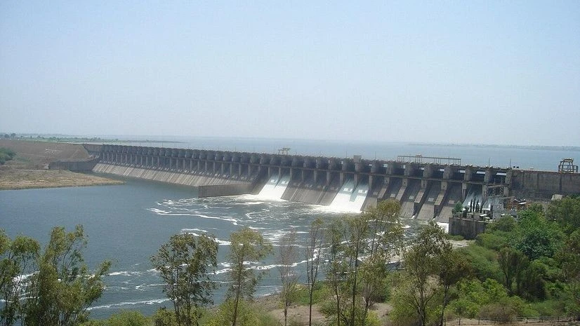
Geographically Solapur is located between 17.10 to 18.32 degrees north latutude and 74.42 to 76.15 degrees east longitude. The district is situated on the south east fringe of Maharashtra State and lies entirely in the Bhima and Seena basins. Whole of the district is drain either by Bhima river or its tributories.
The district is bounded on the north by Ahmednagar and Osmanabad distritcs, on the east by Osmanabad and Gulbarga (Karnataka State) districts, on the south by Sangli and Bijapur (Karnataka State) and on the west by Satara and Pune districts. There is no important hill system in the district. Only in the north of Barshi Taluka several spurs of Balaghat range pass south for a few kilometres. There are also a few scattered hills in Karmala, Madha and Malshiras Talukas. The district in general has flat or undulating terrain. The low table land and small separate hills in Karmala and Madha Talukas act as a Watershed between Bhima and Sina rivers The district covers geographical area of 14844.6 sq.kms. which is 4.82% of the total area of Maharashtra State. Out of the total area of the district 338.8 sq.kms (2.28%) is Urban area whereas remaining 14505.8 sq.kms. (97.72%) is Rural area. Areawise Karmala taluka is biggest covering an area of 1609.7 sq.kms and North Solapur is smallest covering an area of 736..3 sq.kms.
District Profile
Total Area- 14,895 km2 (5,751 sq-mile)
Population- 4,315,527 (2011)
| Sr.No | Name Of Taluka | No Of Villages | Area in Sq.Kms. |
|---|---|---|---|
| 1 | North Solapur | 54 | 736.3 |
| 2 | South Solapur | 90 | 1195.3 |
| 3 | Akkalkot | 135 | 1390.3 |
| 4 | Barshi | 138 | 1483.1 |
| 5 | Mangalwedha | 81 | 1140.9 |
| 6 | Pandharpur | 95 | 1303.6 |
| 7 | Sangola | 103 | 1549.9 |
| 8 | Malshiras | 112 | 1522.2 |
| 9 | Mohol | 104 | 1408.4 |
| 10 | Madha | 117 | 1544.9 |
| 11 | Karmala | 118 | 1609.7 |
The soils of the district can broadly be classified into three types.
- Black
- Coarse Gray
- Reddish
According to topography the district is divided in three natural zones.
- Eastern Zone : This comprises of Barshi, North Solapur, South Solapur and Akkalkot Talukas. The soil is medium to deep black and of rich quality. Jawar, Bajra and Pulses are the main crops of this zone.
- Central or Tansitional Zone : Mohol, Mangalwedha, eastern part of Pandharpur and Madha Taluka are covered by this zone. Like to moderate soil and uncertain rainfall marks this zone. Both Kharip and Rabbi crops are grown in this part.
- Western Zone : Karmala, Sangola and Malshiras Talukas and western parts of Pandharpur comes under this zone. Shallow and poor type of soil, not retentive of moisture marks this part. Scanty and uncertain rainfall. Rabbi crops mainly grown in Karmala, Pandharpur and Madha Talukas while Kharip crops like Bajra and Groundnut are grown in Sangola and parts of Malshiras talukas.
Land Use Pattern
- Agricultural Area – 11480 sq.kms.
- Cultivable not in use – 380 sq.kms.
- Non-agricultural – 690 sq.kms.
- Grass Lands and Herbs – 720 sq.kms.
- Forest Cover – 350 sq.kms.
- Wastelands – 1260 sq.kms.
- Draught prone areas (All eleven talukas) – 14844.6 sq.kms.
Agroclimatically entire district comes under rain shadow area. Rainfall is uncertain and scanty. The monsoon period is from second fortinght of June to end of September bringing rains from south-west monsoon.
Courtesy -: https://solapur.gov.in